Mobile App
2022
-
Spot: Lanternfly
Elimination Assistance
Elimination Assistance
Spot is a tool for tracking and managing the spread of lanternflies, an invasive species that can cause significant harm to the environment and agriculture. It provides users with live-updated maps, reporting features, and detailed information about the presence of lanternflies in their vicinity. Users can report sightings of lanternflies with ease, and collaborate with others in their community to manage the situation. Additionally, the app encourages users to actively participate in environmental conservation efforts by providing a record of the lanternflies they have eliminated and incentivizing them to continue their efforts.
Due to screen size and proportions,
images may appear differently on mobile devices.
If you're browsing on your phone,
tap any image to get a clearer look,
or flip your phone to change the orientation of the display. ︎


Map

Report

Nearby

Profile

Key Feature
Live-updated Map
Live-updated Map
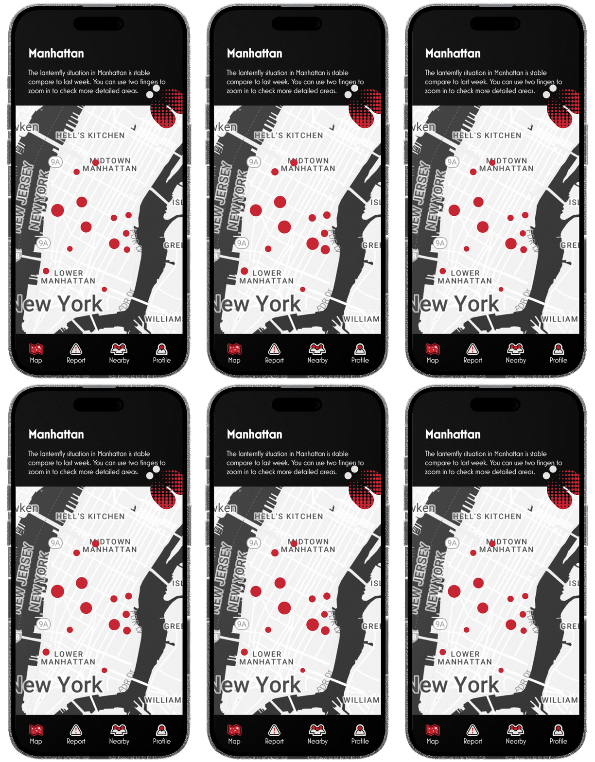
Our app offers a live-updated map that displays the latest data on the presence of lanternflies in a selected area, providing users with a reliable source of information to navigate the situation in their vicinity. This feature also enables authorities to track the spread of this invasive species in real-time, helping them to take timely and targeted measures to mitigate its impact.


Key Feature
Report
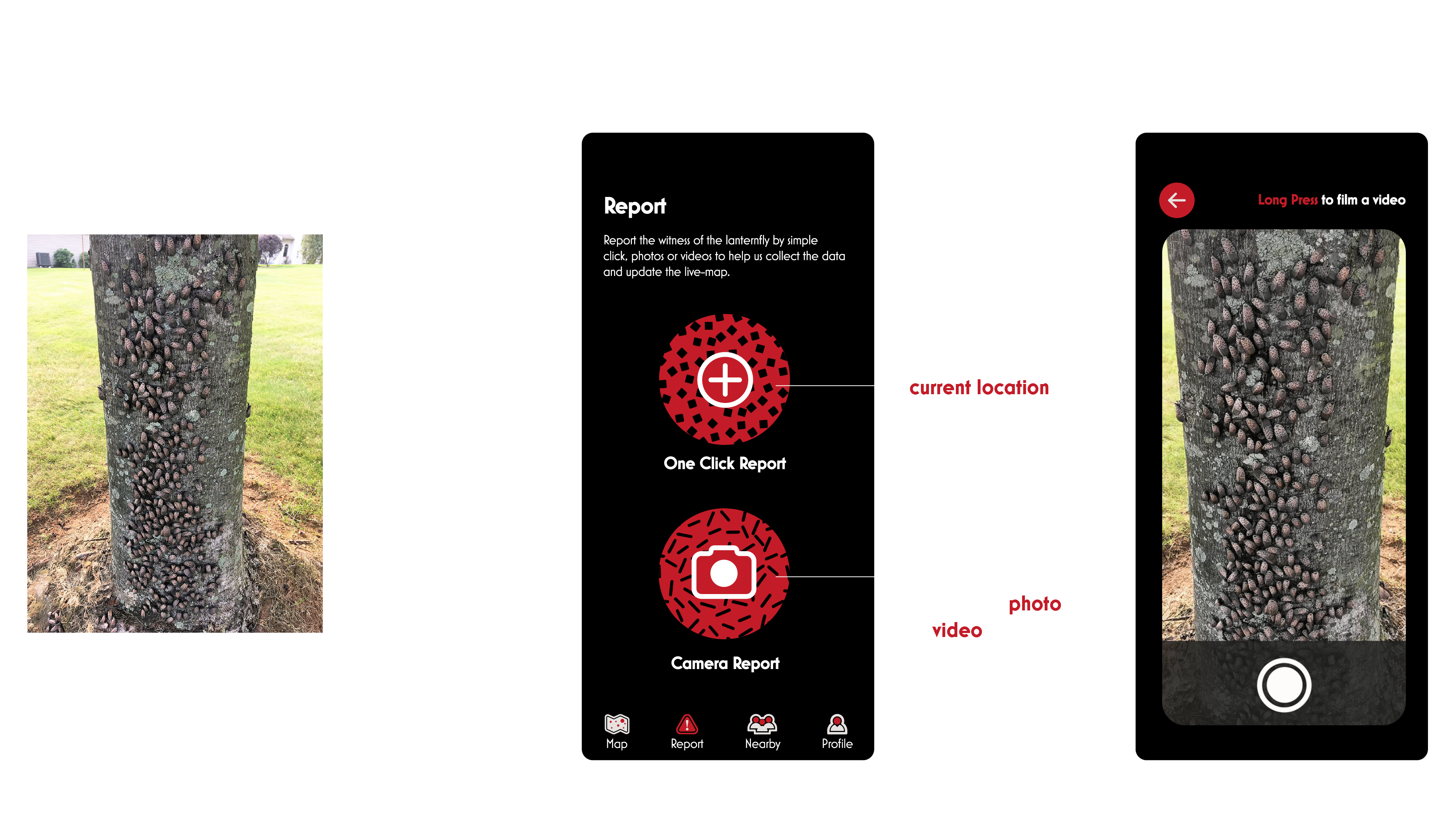
Spot’s Report Page simplifies the process of reporting lanternfly sightings with two user-friendly methods. The One Click Report feature automatically uploads the location of the sighting to the cloud, streamlining the reporting process and minimizing the effort required for users to participate in this important activity. For users who want to provide more detailed information, the Camera Report feature allows them to upload photos of the lanternflies and their location, enhancing the accuracy and usefulness of the report.


]

Key Feature
Nearby
Nearby
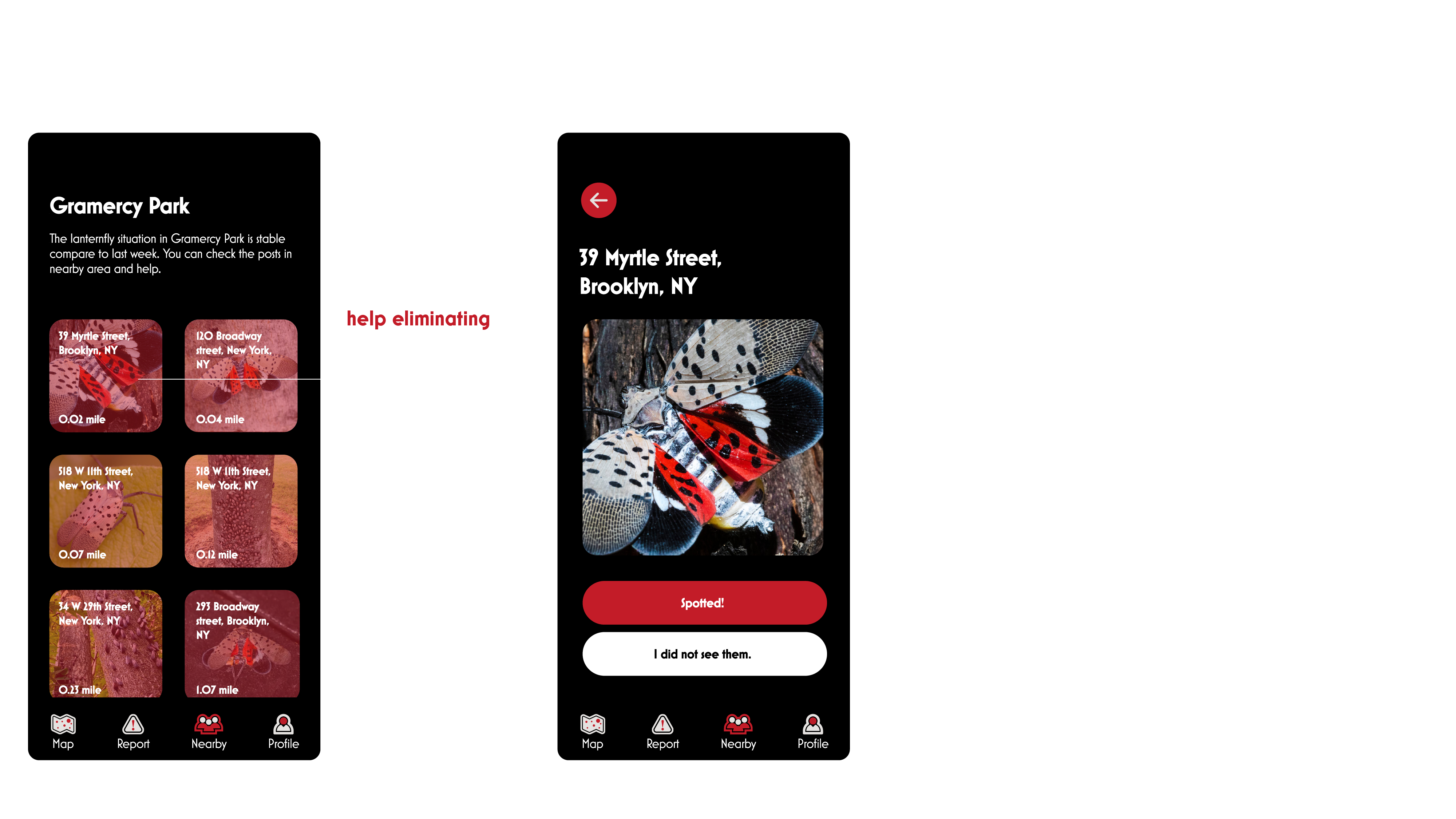
Nearby Page offers a comprehensive and user-friendly way for users to navigate detailed lanternfly reports in their vicinity. Users can access this page to obtain information about the presence and location of lanternflies in their area, and take appropriate action to manage the situation.
For users who prefer not to kill the lanternflies themselves, the app's Nearby Page provides an option to upload information about the sighting and seek help from others in the community.
Moreover, users can also assist others in eliminating lanternflies in their vicinity, promoting a spirit of community involvement and cooperation in environmental conservation efforts.


Key Feature
Profile
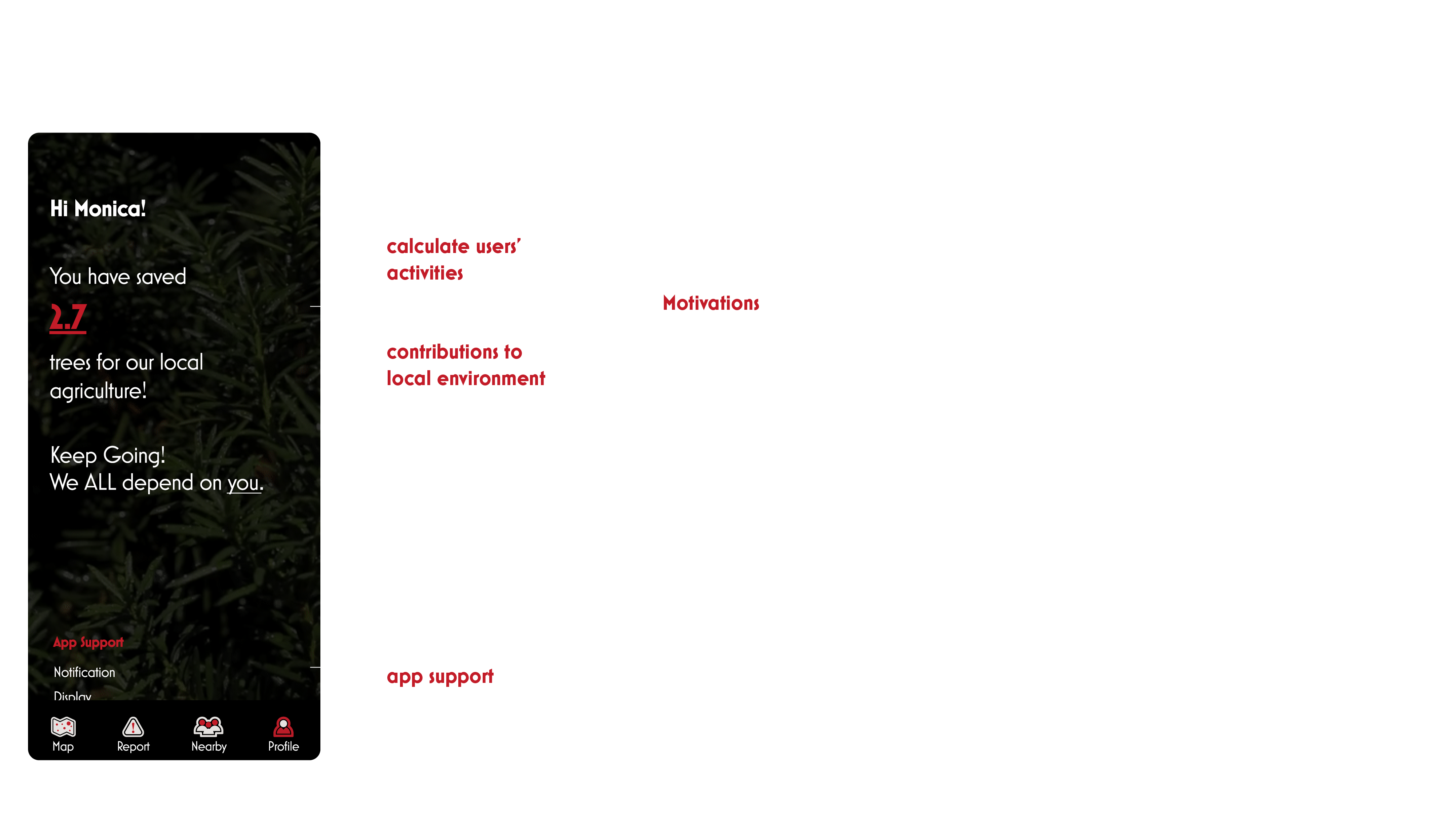
Profile Page displays data on the lanternflies that users have eliminated, directly contributing to environmental conservation efforts. This information serves as a record of the user's contribution to protecting the environment and helps them track their impact on the spread of this invasive species.
By providing a visual representation of the user's contribution to environmental conservation, our Profile Page incentivizes users to actively participate in the effort to eliminate lanternflies. Users can view their progress and see the impact of their actions, which motivates them to continue their efforts and encourages others to join in.

